


Giant of the Three Nations
Between towering peaks and glacial lakes
Before you set off:
Route type
hiking
66.4 kilometres
of adventure
5,390 m ascent
ever higher
6 days
of pure joy
Difficulty
Hard
Season
July to September
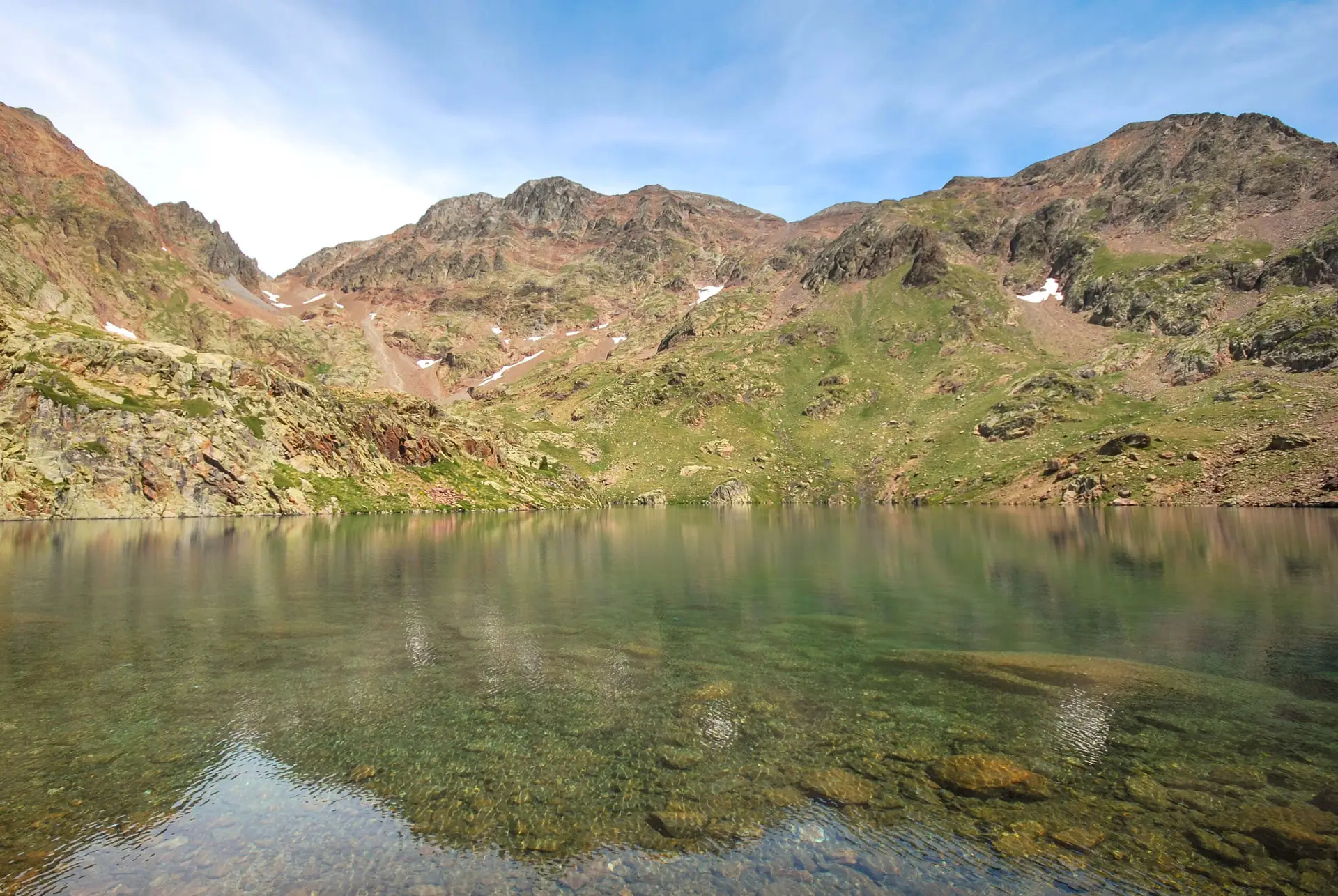
Overview of the Itinerary
“Giants of the Three Nations” is a magnificent cross-border hiking route between France, Spain and Andorra.
Designed for experienced hikers, this high-mountain route crosses varied landscapes and takes you close to the region’s highest peaks.
Along the way, you pass through three outstanding protected areas: the Parc Naturel Régional des Pyrénées Ariégeoises, the Parc Natural de l’Alt Pirineu and the Parc Natural de la vallée de Coma Pedrosa. You move from glacial valleys to renowned forests, between lakes and rocky summits, and end each day in a welcoming mountain hut.
An adventure you won’t soon forget!
Key points of interest
1
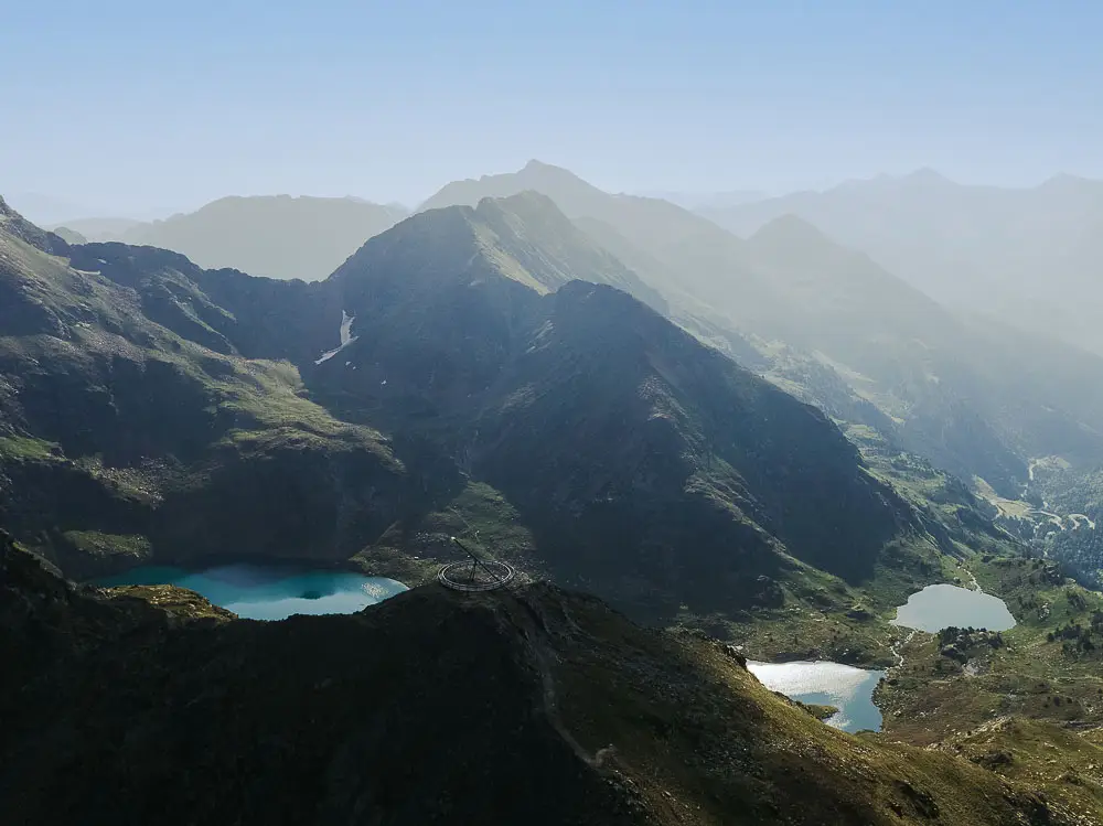
Pic de Tristaina — Andorra
Information
An iconic summit marking the gateway to Andorra’s high-mountain landscapes.
Photo: © Makoki20 WikimediaCommons
2
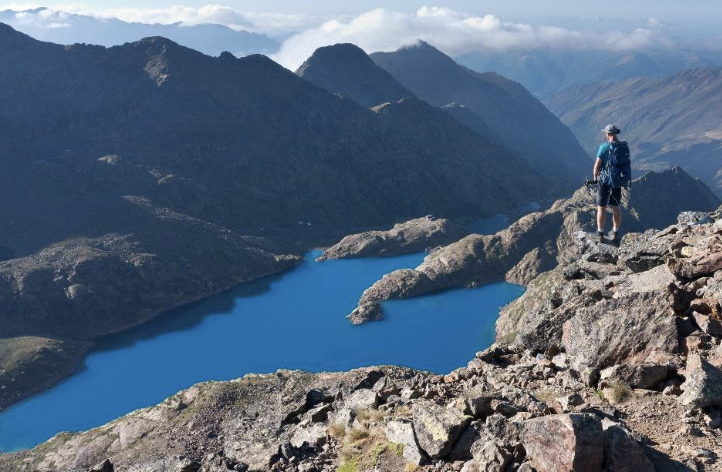
Étangs and Pic de Fourcat
Information
Located in the Ariège Pyrenees, the Fourcat ponds nestle in a high-mountain setting at the foot of Pic de Fourcat. Surrounded by rocky peaks and wild landscapes, they make a remarkable stop to discover the natural richness of this Pyrenean massif.
©David Genestal Ariège Pyrénées Tourisme
3
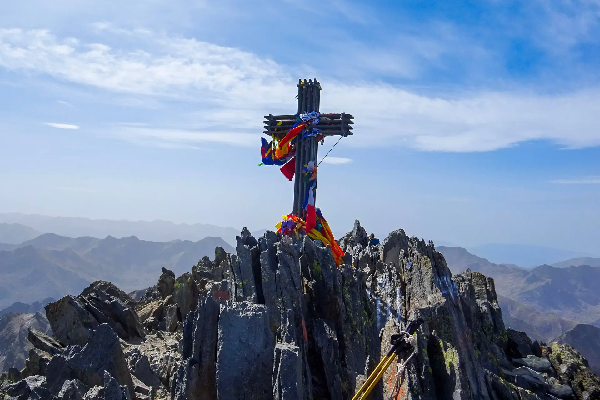
Pica d’Estats — Pallars Sobirà
Information
Rising to 3,143 metres, Pica d’Estats is Catalonia’s highest peak. Located on the border between Catalonia and Ariège, it offers exceptional panoramas over the Pyrenees and is an iconic summit for experienced hikers.
4
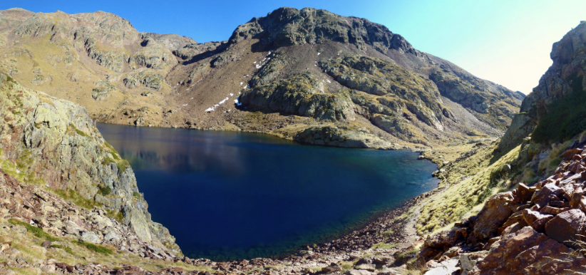
Estany i Port de Sotllo
Information
Set at the foot of the Pica d’Estats massif, Lake Sotllo is a high-altitude lake surrounded by wild landscapes and steep peaks—an unmissable stop on Pyrenean high-mountain hiking routes.
At 2,874 metres, the Sotllo pass is a high-mountain pass linking Catalonia to Ariège. It offers spectacular views of the surrounding peaks and is an iconic crossing point in the Pyrenees.
© Antoni Pons Oliver
5
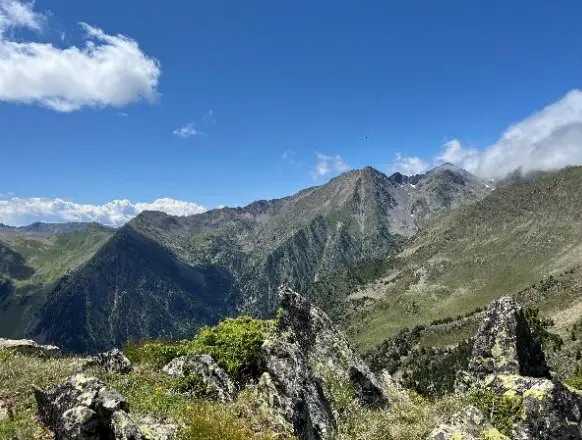
Pic de Comapedrosa — Andorra
Information
Rising to 2,942 metres, Pic de Comapedrosa is Andorra’s highest peak. Located in the Comapedrosa Valleys Natural Park, it offers exceptional panoramas over the surrounding mountains and is an iconic ascent for experienced hikers.
©Andorra Turisme
Stage descriptions
Freedom above all: this itinerary can be customized, with the option to select specific stops.
Day 1
Stage 1
This first stage takes you from the village of El Serrat to the Estany Fourcat mountain hut: 11.5 kilometres of hiking with 1,310 metres of ascent. You start by following the Tristagne stream. Around kilometre 6, you reach the Tristagne ponds, nestled in a stunning mountain setting. The climb to the Tristagne summit is optional, but well worth it! At 2,878 metres, it offers an exceptional panorama over the Fourcat cirque and the surrounding ponds. From there, all that’s left is to descend to Estany Fourcat and its wonderful mountain hut.
Points of interest
1
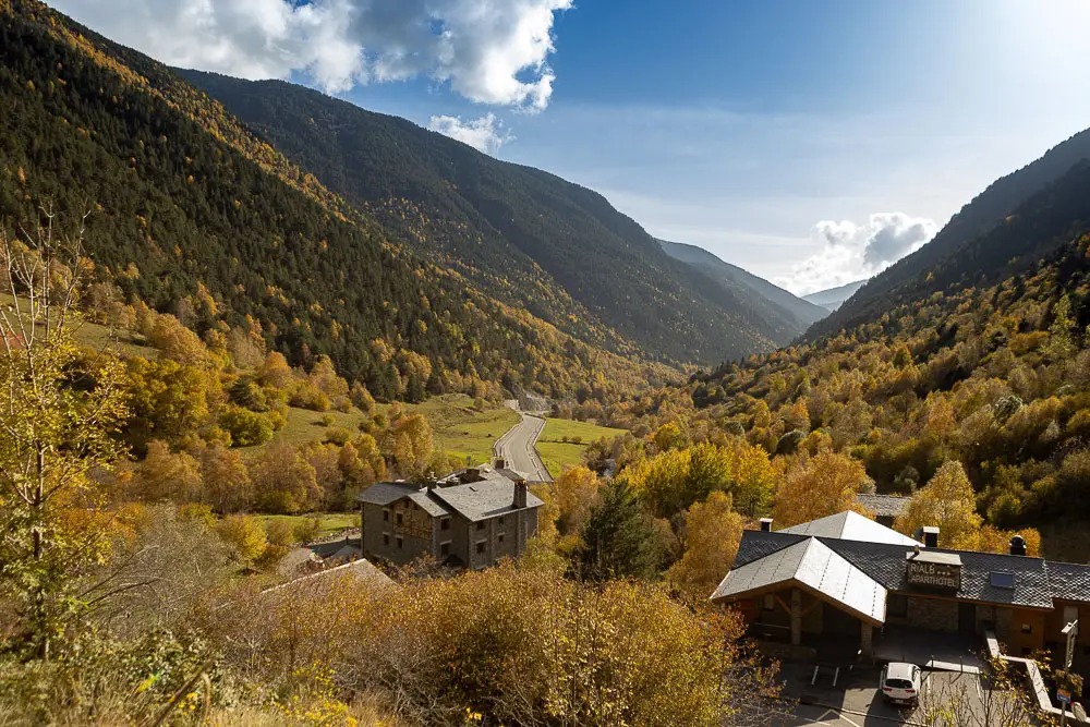
El Serrat (1,560 m)
Information
A small mountain village in the parish of Ordino, in the heart of a preserved natural environment. Surrounded by forests and alpine landscapes, it is the starting point for the crossing towards the Pyrenean peaks.
Photo: © Andorra Turisme
2
Coll dels Abòs (1,722 m)
Information
A mountain pass above the village of El Serrat, offering a first immersion in Andorra’s mountain landscapes. It marks the transition between inhabited valleys and high-mountain areas.
3
Pic de Tristaina (2,878 m)
Information
An iconic Andorran summit offering magnificent panoramas over the Pyrenees. Its rocky ridges and high-mountain setting make it one of the highlights of the crossing.
Photo: © Andorra Turisme
Day 2
Stage 2
You start the day in the heart of the mountains, then continue through forest. On today’s programme: around the fifth kilometre, Lake Izourt offers another postcard-perfect view. You continue your descent until you reach Monicou, a lovely hamlet typical of the valley, where you spend the night.
Points of interest
1
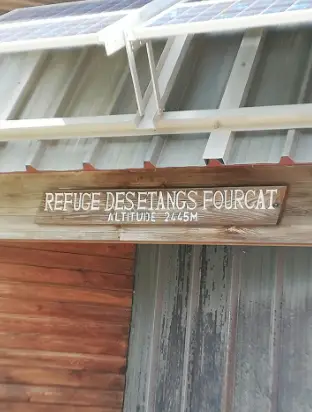
Refugi de l’Estany Forcat (2,445 m)
Information
A mountain hut in a remote part of Ariège, amid high-altitude lakes and rugged terrain. It is an ideal stop to discover the wild landscapes of the Pyrenean high mountains.
Copyright: Enseigne-refuge-fourcat-©C-Bayard Ariege Pyrenees Tourisme
2
Étangs and Pic de Fourcat
Information
Located in the Ariège Pyrenees, the Fourcat ponds nestle in a high-mountain setting at the foot of Pic de Fourcat. Surrounded by rocky peaks and wild landscapes, they make a remarkable stop to discover the natural richness of this Pyrenean massif.
© David Genestal Ariège Pyrénées Tourisme
Day 3
Stage 3
This third stage is short in distance but intense in terms of ascent. From Monicou, the trail climbs through the beautiful Fontanal forest, offering lovely views of the surrounding mountains. Around the seventh kilometre, you discover Lake Sourd. From there, less than two kilometres separate you from the Pinet mountain hut, your home for the night.
Points of interest
1
Mounicou
Information
A small mountain village in Ariège, Mounicou is nestled in a lush setting of forests and Pyrenean valleys.
2
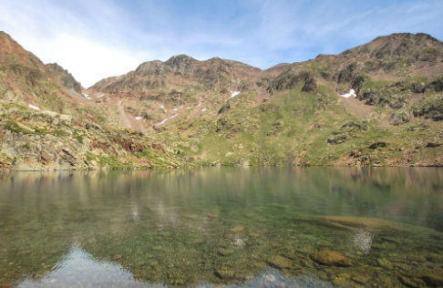
Estany Sourd
Information
A mountain lake in the Pica d’Estats massif, in a pristine, mineral environment. It signals your arrival in the high-altitude landscapes around the Pinet mountain hut.
3
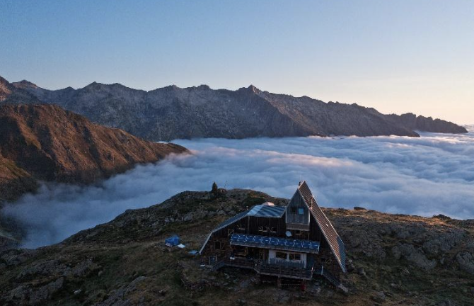
Refuge de Pinet
Information
At the foot of the Montcalm massif, the Pinet mountain hut is a high-mountain stop surrounded by peaks and glacial lakes. It is a prime starting point for the ascent of Pica d’Estats.
©David Genestal Ariège Pyrénées Tourisme
Day 4
Stage 4
This fourth stage is incredible: it takes you to the Vallferrera mountain hut through a landscape dominated by red rock and mountain lakes. From the Pinet mountain hut, there’s not much of a warm-up. The climb is steep and sustained, but it offers beautiful plunging views over the États canyon. After just over three kilometres, you pass the Coumette pass and then the Riufret pass. You’re already almost at 3,000 metres! You climb to Pica d’Estats, at 3,143 metres. The summit marks the border between France and Spain. From there, you descend through a mineral landscape towards Port de Sotllo. Your descent to the Vallferrera mountain hut is dotted with mountain lakes.
Points of interest
1
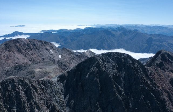
Montcalm massif
Information
A high-mountain massif on the border between Ariège and Catalonia, characterised by its lofty peaks and rocky landscapes. It forms one of the most spectacular mountain groups on the crossing.
©David Genestal Ariège Pyrénées Tourisme
2
Port de Riufred (2,978 m)
Information
A high-altitude pass in the Montcalm massif, near Pica d’Estats. This crossing immerses you in a demanding, mineral landscape typical of the Pyrenean high mountains.
3
Pica d’Estats (3,143 m)
Information
Rising to 3,143 metres, Pica d’Estats is Catalonia’s highest peak. Located on the border between Catalonia and Ariège, it offers exceptional panoramas over the Pyrenees and is an iconic summit for experienced hikers.
4
Port de Sotllo (2,874 m)
Information
A high-mountain pass on the border between Ariège and Pallars Sobirà. It marks the crossing between the two sides of the Pica d’Estats massif and opens the way down to the Vall Ferrera valley.
©Antoni Pons Oliver
Day 5
Stage 5
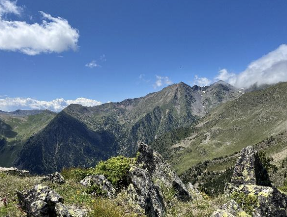
The penultimate stage of the adventure. You set off from the Vallferrera mountain hut with one goal: the summit of Comapedrosa, at 2,942 metres. It’s Andorra’s highest peak, and your ascent will be rewarded with magnificent views of the highest peaks of Andorra, France and Catalonia, including Pica d’Estats, which you climbed the day before. Your descent takes you to Lake Comapedrosa, then to the mountain hut of the same name, where you’ll spend the night. Time to recover after completing just over 1,000 metres of ascent on this stage.
Points of interest
1
Comapedrosa (2,942 m)
Information
Rising to 2,942 metres, Pic de Comapedrosa is Andorra’s highest peak. Located in the Comapedrosa Valleys Natural Park, it offers exceptional panoramas over the surrounding mountains and is an iconic ascent for experienced hikers.
©Andorra Turisme
2
Baiau area
Information
Located on the border between Andorra and Pallars Sobirà, the Baiau area stands out for its glacial lakes and high-mountain landscapes. It is an iconic section of the cross-border crossing.
Day 6
Stage 6
Just over 14 kilometres separate you from the village of El Serrat, where your adventure began. Much of today’s route is through forest, before you meet the Tristagne stream again and follow it back to El Serrat.
Points of interest
1
Collet de la Coma Pedrosa
Information
A mountain crossing in the Comapedrosa area, at the heart of an alpine landscape characterised by ridgelines, rocky slopes and panoramas over the surrounding peaks.
2
Coll de les Cases:
Information
A pass in the mountains of Andorra, offering views over the surrounding ridges and valleys. It is a crossing point in this mid- and high-mountain environment.
The following bus companies run regular services between Barcelona and Andorra
- ALSA (several routes departing from Barcelona’s Estació del Nord bus station): alsa.es
- ANDBUS (departing from Barcelona Airport): andorrabybus.com
- DIRECT BUS (departing from Barcelona Airport): andorradirectbus.es
The following bus companies run regular services between Lleida and Andorra
- ALSA: alsa.es
- Grupo MONTMANTELL
Regular local bus routes linking Andorra la Vella to Arinsal or El Serrat run frequently during the summer. Timetables, stops and fares are available on Andorra’s official mobility website: mobilitat.ad
If you are travelling by public transport, please inform the DMC so they can coordinate your arrival.
Cross-border gatherings of the Three Nations Pyrenean Park
August and early September · Ariège, Pallars Sobirà and Andorra
They bring to life the historic ties between mountain communities across border passes, with meetings between locals, shepherds and visitors. In 2026, gatherings took place at Port de Salau, Port de Bouet (Auzat) and Port del Rat, with Andorra taking part.
Iron Fair in the Pyrenees
July: Alins, Vall Ferrera (Pallars Sobirà)
A fair dedicated to iron and traditional blacksmithing, with workshops and activities linked to craft trades. It’s a great option as it takes place in Vall Ferrera, very close to the Catalan section of the crossing, and helps showcase the cultural heritage of a mountain valley beyond hiking.
International Cheese Fair
August · Escaló, Pallars Sobirà
A gastronomic event focused on artisanal products, livestock farming and mountain food culture. It’s an excellent complement to the itinerary for visitors interested in local cuisine, even though it is not directly on the walking route.
Source: Pallars Sobirà Tourist Office
La Pitavola del Comapedrosa
Late September – early October · Arinsal
A popular festival linked to the Comapedrosa Valleys Communal Natural Park, with local products, workshops and activities that highlight the natural setting.
Sheep Fair and sheepdog competition
A festival linked to the xisqueta sheep, a native breed from Pallars, to pastoralism and traditional trades. It’s useful for putting the relationship between local communities and the mountains into context. Its location is less directly connected to the itinerary than the Iron Fair, so it should be presented as a complementary option in the region rather than an event on the route itself.
Source: Pallars Sobirà Tourist Office
Pallars Witches and Enchantresses Fair
August · Ribera de Cardós
A popular culture fair that brings to life legends, local tales and traditions linked to witchcraft in Pallars. It’s a great way to add a legendary and ethnographic dimension to the Pyrenean experience.
Source: turisme.pallarssobira.cat/que-fer/festes-i-tradicions/
Salt Festival
August · Gerri de la Sal
A day dedicated to crafts, local products and salt heritage. It’s a great cultural and gastronomic option to discover Pallars Sobirà, although it is farther from the main route.
Source: turisme.pallarssobira.cat/que-fer/festes-i-tradicions/
Gourmet Transhumance
July and August · Plateau de Beille, Ariège
An experience combining the discovery of transhumance and pastoralism with a mountain gastronomic offering.
Source: pyrenees-ariegeoises.com/a-voir-a-faire/sortir/agenda/
Patron saint festivals in Ordino and La Massana
July and August · Andorra
Patron saint festivals are a great way to immerse yourself in local life, with music, community activities and gastronomy. Those in Ordino and La Massana are especially relevant due to their proximity to the Andorran section of the crossing. Dates change every year.
Mountain Festival Comapedrosa
July · Arinsal
An event combining several trail-running races from the international XTERRA Trail Run World Series circuit with a wide programme of wellbeing and leisure activities designed for all audiences. Beyond the competitions, the programme includes guided hikes, children’s races, yoga and Pilates sessions, live music, nature workshops and local gastronomy experiences. A unique way to enjoy sport, nature and the high-mountain setting of Arinsal.
A privileged summer experience
The route is designed to be completed exclusively from July to September. This is the only period that brings together the conditions needed for this adventure: it ensures accommodation availability, mild weather and a manageable level of difficulty. The itinerary was therefore designed to showcase the mountains in summer, allowing every participant to enjoy the experience safely and in the best possible conditions.
Travel Better, All Year Round
Traveling better means choosing a form of tourism that is more respectful of local communities and the people who bring them to life. Through these itineraries, the project invites you to slow down, immerse yourself in the landscapes, meet the locals, and celebrate local craftsmanship, all while adopting responsible and sustainable practices.